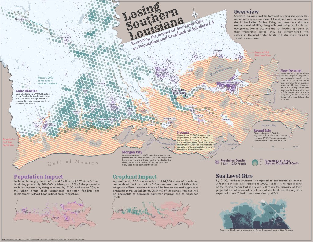
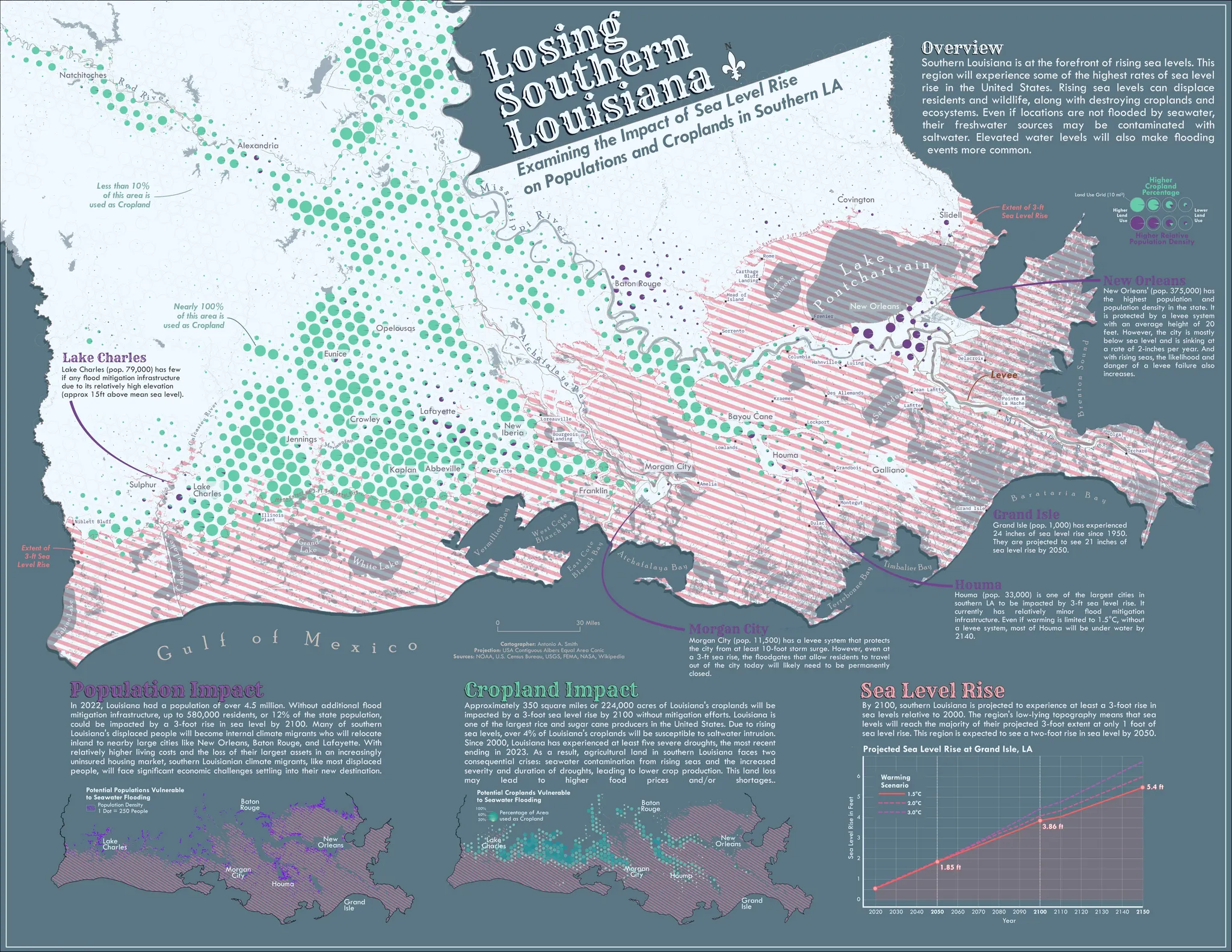
Examining the Impact of Sea Level Rise on Populations and Croplands in Southern Louisiana

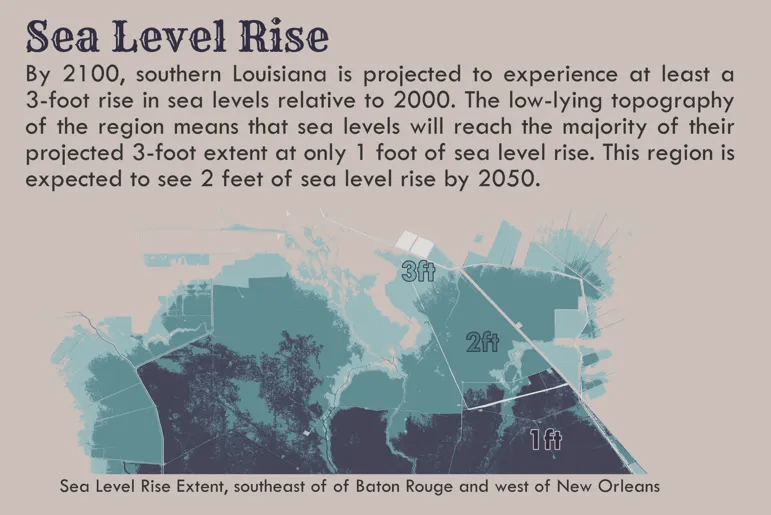
I created this bivariate map in my cartography course at Johns Hopkins. The map illustrates the impacts on populations and cropland from a 3-foot sea level rise (SLR) in southern Louisiana. However, it is worth noting that coastal Louisiana is expected to experience around 3.8 feet of sea level rise in a 1.5°C scenario. The 3-foot SLR extent was readily available from NOAA.
The Population Impact map shows the estimated residents below the projected relative mean sea level in 2100 as a standalone dot density layer. Only the potentially impacted populations are shown.

The Cropland Impact map shows the estimated cropland below the projected relative mean sea level in 2100 as a Wurman dot layer. As with the population impact map, only the impacted croplands are shown.

The Sea Level Rise (SLR) inset map shows the extent of relative sea level rise in 1-foot SLR increments.
Each dot represents 250 people, and the scale and shade of the Wurman dot represents the coverage of cropland per 10 square mile area. Each cell is a hexagon; however, I found the circles are more intuitive to read. I wasn’t in love with this bivariate map. It was required for the course.
I made a revised version using a combination of Wurman dots and pie charts. Typically, pie charts are frowned upon on maps; however, I think they work well here. Limiting the variables to two eliminates the normal difficulties of using pie charts on maps.
Map Details
| Map Size | ANSI C |
|---|---|
| Map Scale | |
| Map Projection | USA Contiguous Albers Equal Area Conic |
| Data Sources | NOAA, U.S. Census Bureau, Kontur, USGS, FEMA |
| Tools | ArcGIS Pro: General data processing and map creation. Affinity Designer: Final map assembly RStudio: SLR Chart (Alternative Version) |