All maps were made with QGIS and Affinity Designer. The Rhode Island Hillshade map was made with Rayshader in RStudio and Affinity Designer.
#Social Media (Bluesky)
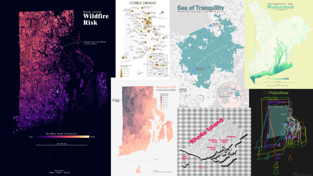
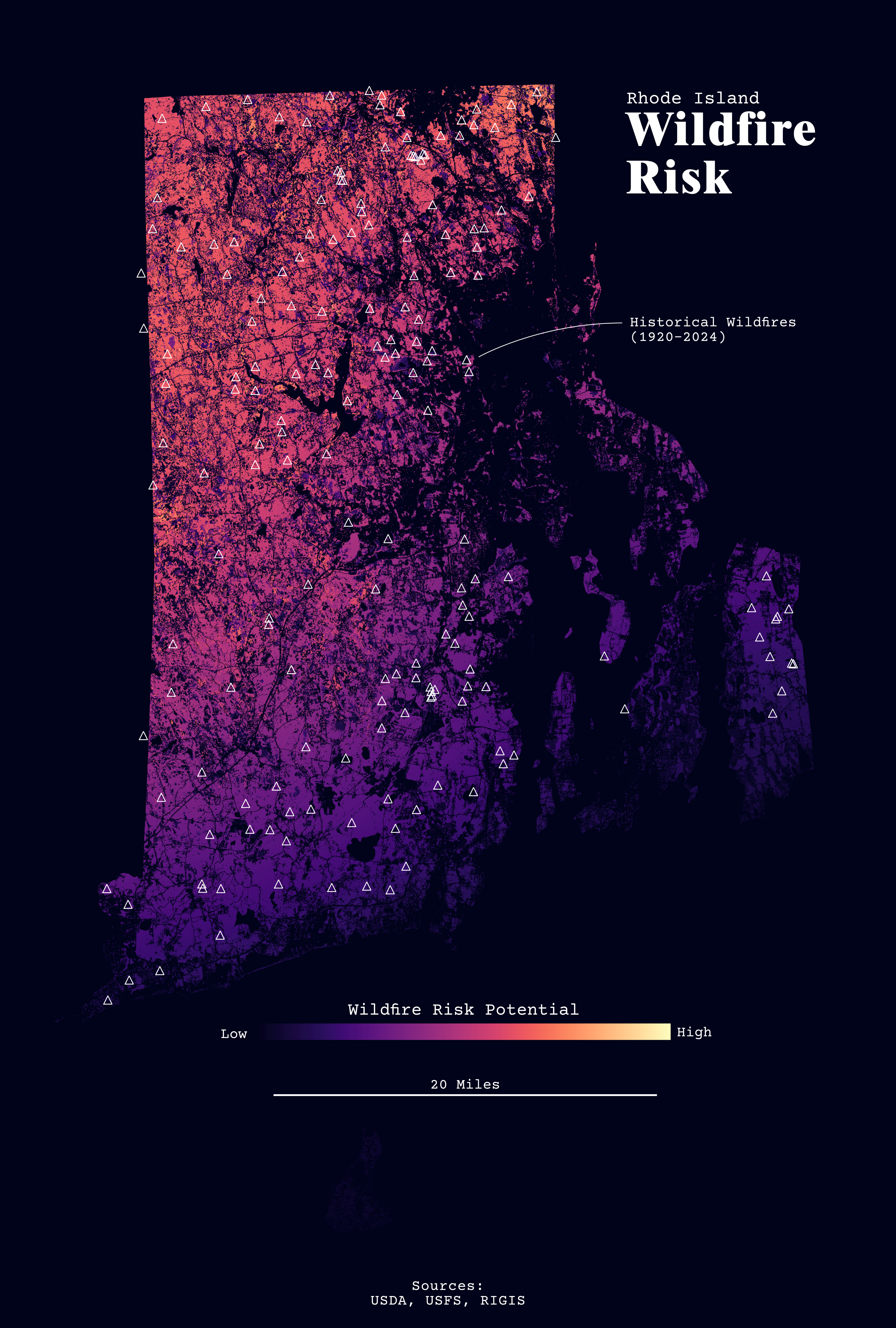
Day 15 – Fire Rhode Island Wildfire Risk
Day 15 – FireRhode Island Wildfire RiskI swear I am not making the same forest map over and over again. 😂Overall, RI has a very low wildfire risk. It is probably no surprise that the forested areas are at higher risk. The risk also increases from north to south.#30DayMapChallenge
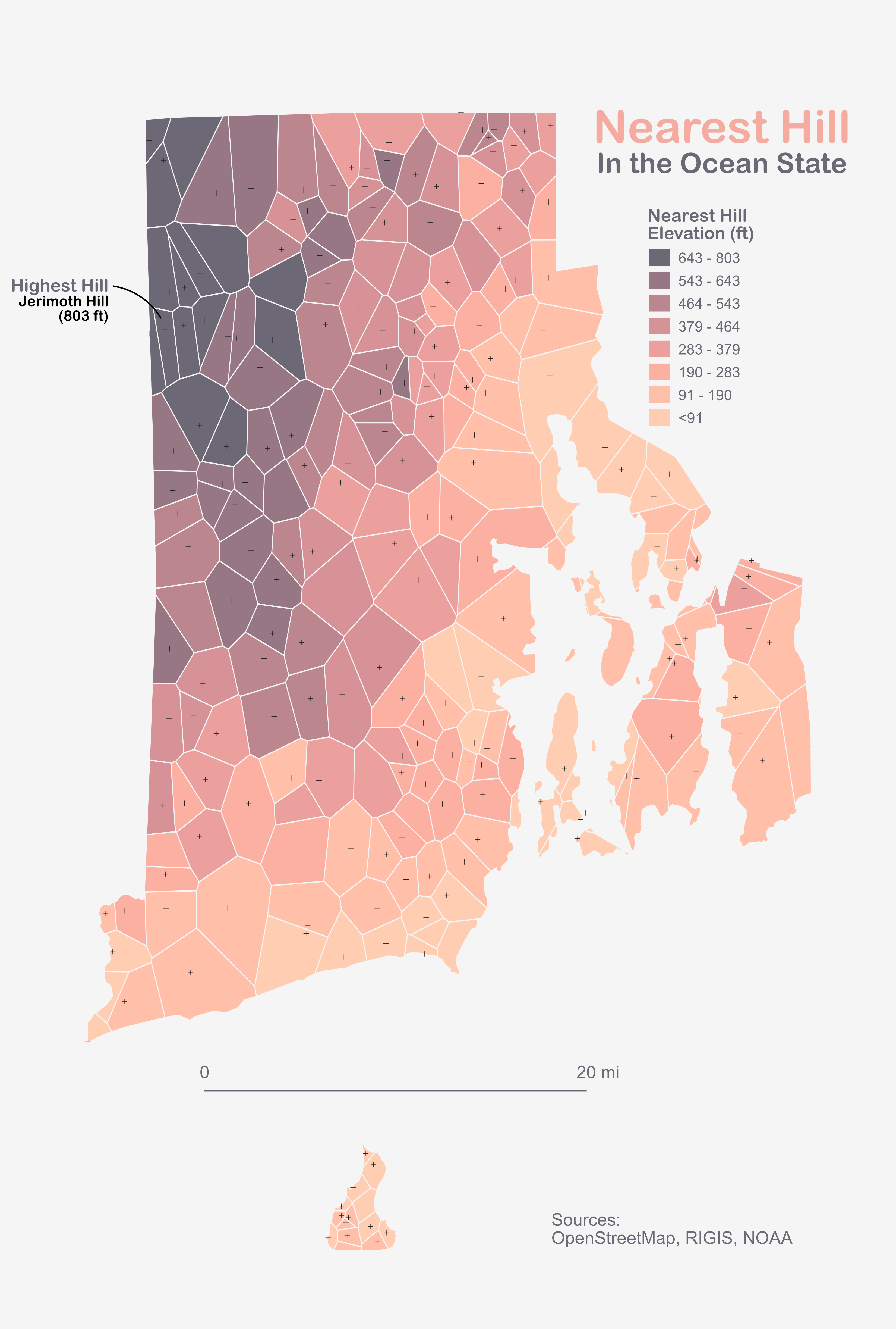
Now with more accuracy! 😅I goofed and got my meters and feet mixed up. Thanks to @bboucek.bsky.social for catching that! Normally, I reproject my DEM so I don't have to do the conversion later. I forgot this time.The highest point in RI is still Jerimoth Hill at 803ft (244m).#30DayMapChallenge
Day 17 – A New ToolRhode Island HillshadeI am a day or two behind now. I finally got #Rayshader installed; it was a whole ordeal. This map is nothing crazy. Just a hillshade of Rhode Island that I annotated in #AffinityDesigner. #30DayMapChallenge
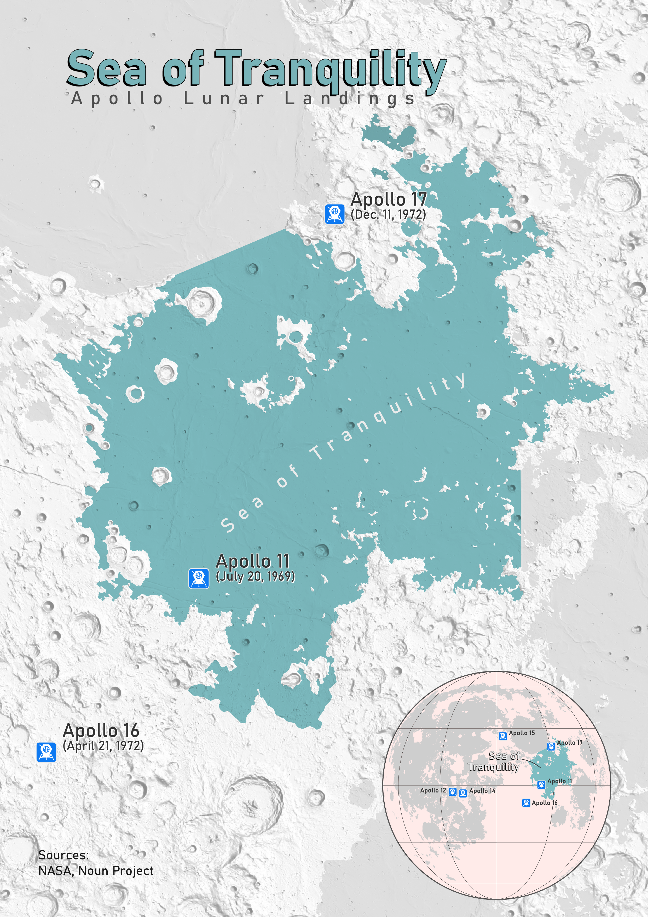
Day 18 – Out of This World Sea of Tranquility Apollo Lunar Landings
Day 18 – Out of This WorldSea of Tranquility Apollo Lunar LandingsTechnically, there is just the one Apollo mission in the Mare Tranquilitus, but the others are in the extent. Fun fact: I grew up in the Rocket City, and I was born on the anniversary of a lunar landing. #30DayMapChallenge
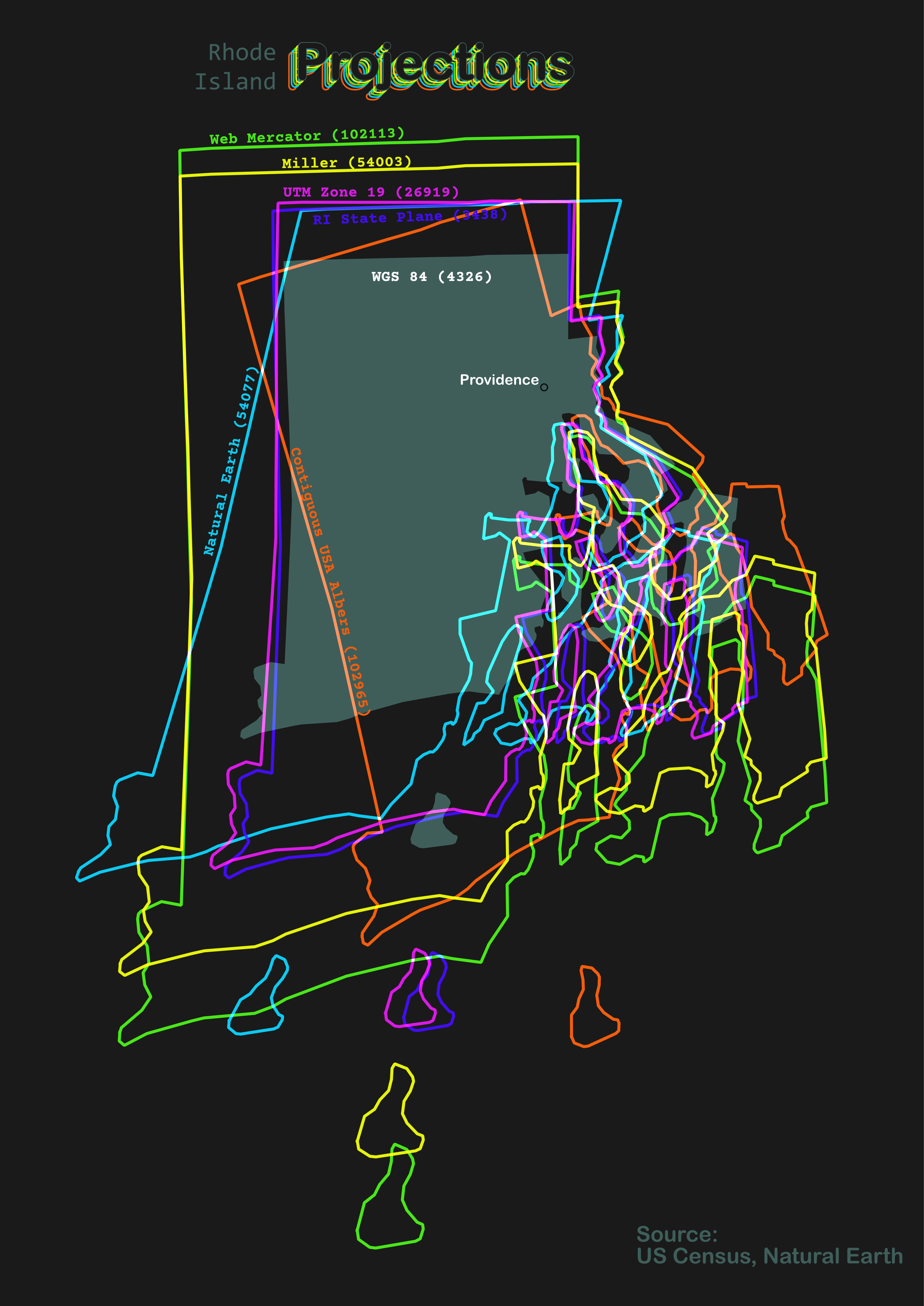
Day 19 – Projections (GIS Day) Rhode Island Projections
Day 19 – ProjectionsRhode Island ProjectionsAll caught up!I wanted to compare a few projections I have tried with my Rhode Island maps. These projections are centered on Providence, similar to @kennethkhw.bsky.social map.#30DayMapChallenge
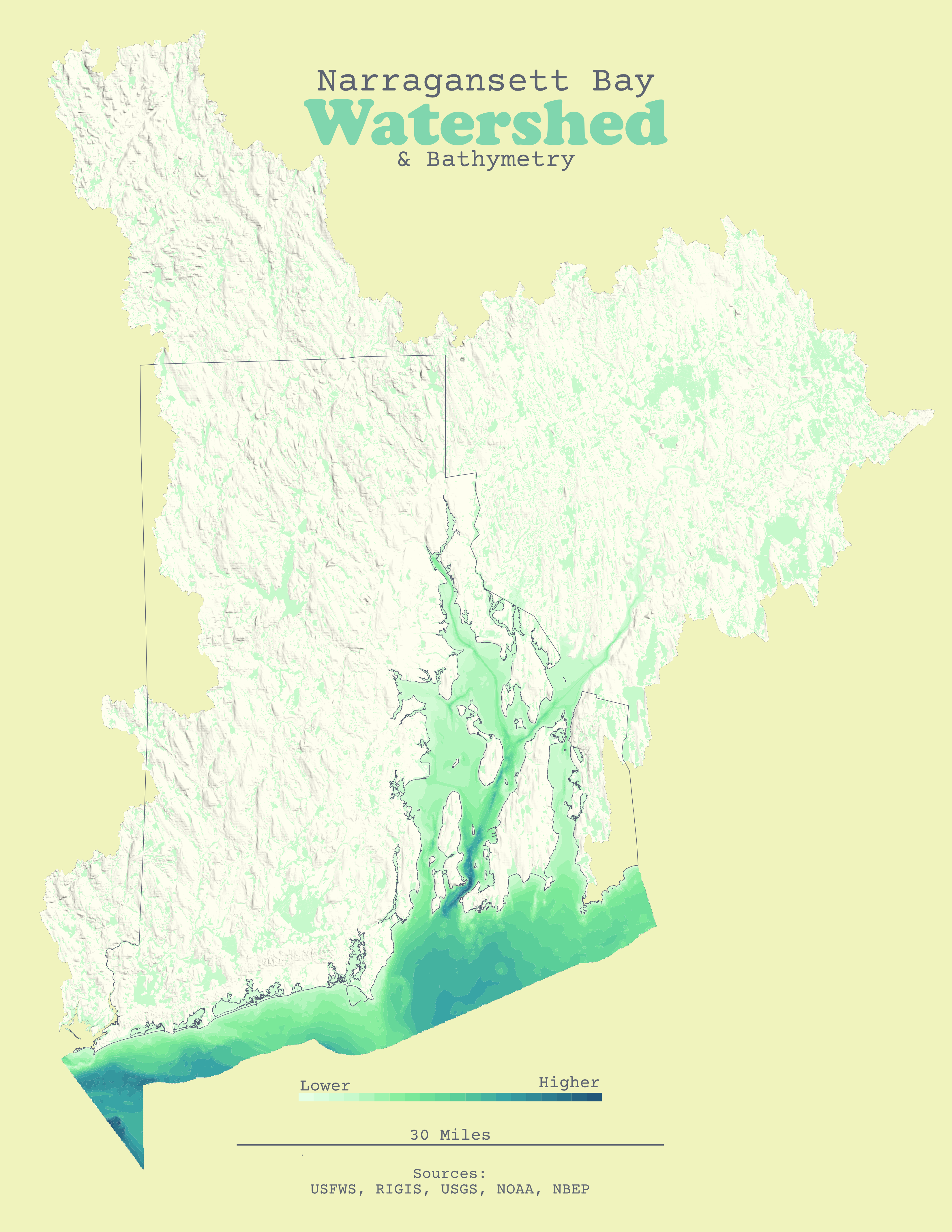
Day 20 – WaterNarragansett Bay Watershed10 Days to go! I am starting to feel a little repetitive. 😰 The bathymetry saved this one. Almost all of Rhode Island is in the Narragansett Bay Watershed. I think I will expand this one into a large format map one day.#30DayMapChallenge
Day 21 – IconRhode Island Public LibrariesHere are the Public Libraries across Rhode Island. The symbol is from the @nounproject.bsky.social, which is probably one of the best subscriptions I have. The symbols are graduated by square footage. #30DayMapChallenge