It is November, and that means it is time for the 30DayMapChallenge! This is the third time I have participated in the 30DMC, and I have only mostly completed it once. It is very difficult to come up with new creative ideas every day for a month without repeating yourself.
This year, I decided to focus a single area of interest (AOI) for most of my maps: Rhode Island. I feet like a good way to better understand a place is to make a map of it. You also learn about new datasets as well.
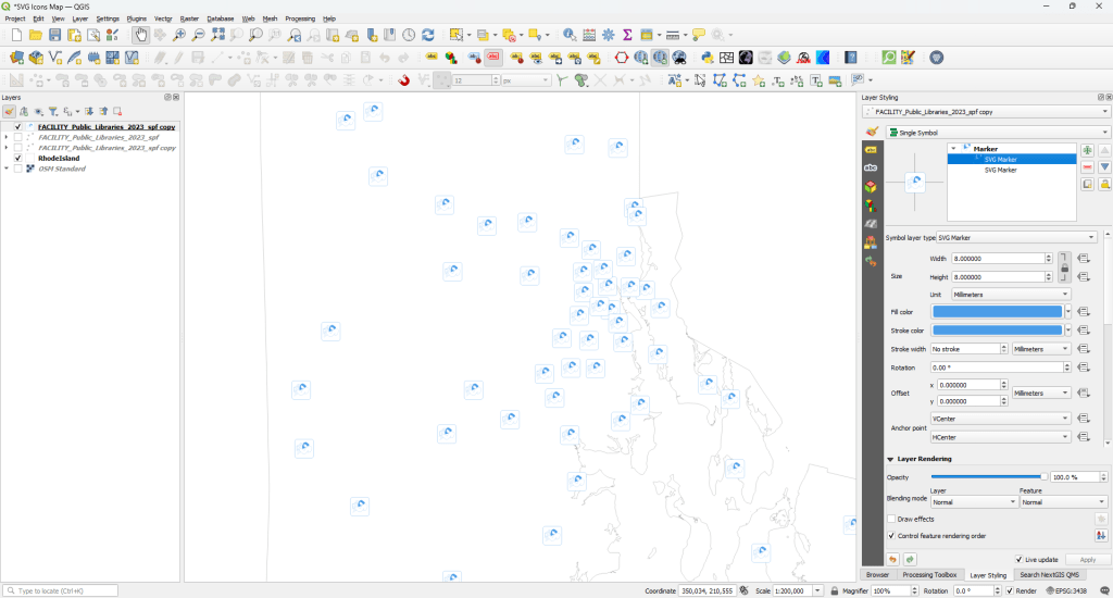
All maps were made with QGIS and Affinity Designer.
#Social Media (Bluesky)
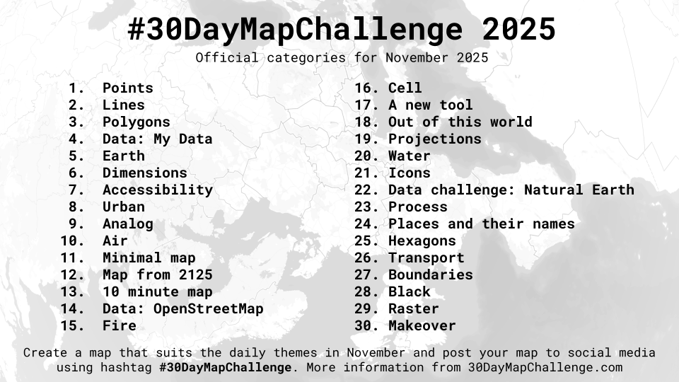
Day 1 – Points Rhode Island Lighthouses
Day 1 – PointsRhode Island LighthousesMost of my maps will be about Rhode Island. A good way for me to learn about a place (and find datasets) is to try to create a map of a thing.#30DayMapChallenge
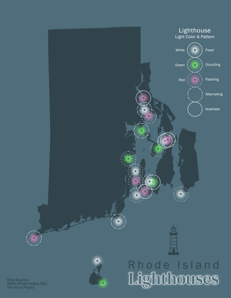
Day 2 – Lines Rhode Island Historical Hurricanes (1851-2024)
Day 2 – LinesRhode Island Historical Hurricanes (1851-2024)Someone made a map of hurricane tracks over FL for a previous 30 Day challenge. I don't remember who it was, and I can't find their info. It was on the old site. Either way, that map inspired me to make one for RI.#30DayMapChallenge
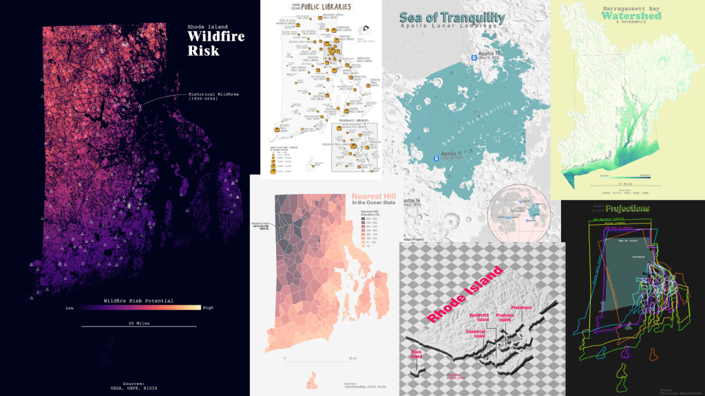
Day 3 – PolygonsThe Native Lands in Rhode IslandOne of my carto goals is to make a big map of the native lands in the US. Judging by my experience with this RI map, I may have to map by region or state level. Lots of boundaries overlap, making it difficult to show them all.#30DayMapChallenge
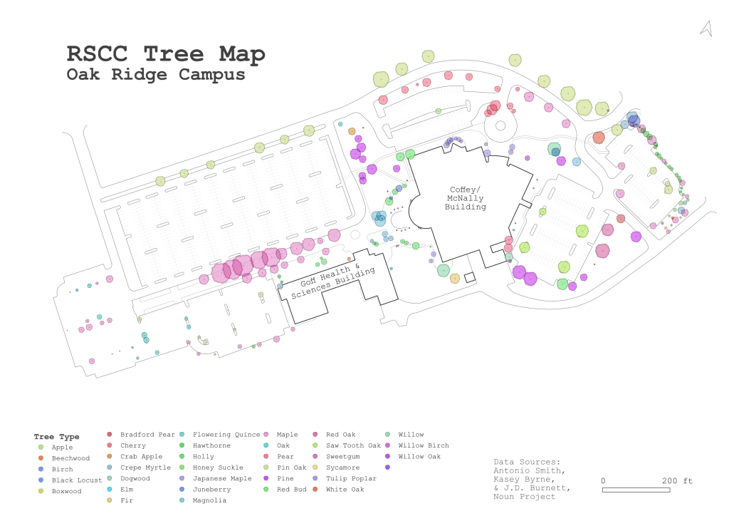
Day 4 – My DataRSCC Tree MapA couple of summers ago, RSCC students Kasey Byrne and JD Burnette helped me map the trees at the Oak Ridge campus. They logged the tree species, heights, diameters, canopy, and general health. I digitized the other campus features. #30DayMapChallenge
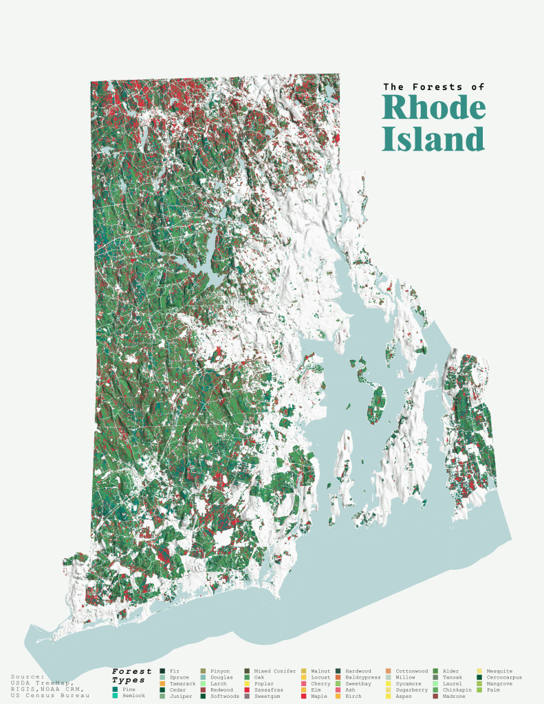
Day 5 – EarthThe Forests of Rhode IslandBack to Rhode Island! This is an extension of my East TN Forests map. I may make a state-level series out of these.(Sorry Block Island, I had to clip you out of this one.) #30DayMapChallenge
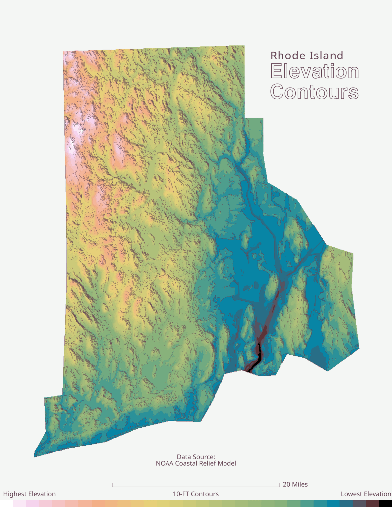
Day 6 – Dimensions Rhode Island Elevation Contours
Day 6 – DimensionsRhode Island Elevation ContoursI tried using the 2.5D tools in QGIS for this one, but I didn't like how they turned out. After creating the color ramp, I added the shadows in Affinity Designer. This gave the contours a 3D effect.#30DayMapChallenge
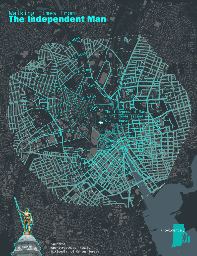
Day 7 – Accessibility Walking Times from the Independent Man
Day 7 – AccessibilityWalking Times from the Independent ManThe Independent Man is a gold-plated bronze statue on top of the Rhode Island State House, located in Providence, RI. This is an isochrone map that I made more complicated by symbolizing the roads by color and weight.#30DayMapChallenge